Summer 2020 update: Returning to this location in 2020 we discovered the upper reaches of this paddle had begun to fill with silt. While it was possible to navigate through the area paddling became more difficult. We’ve agreed this area is no longer quality kayaking and we will probably not return. This area is a prime example of changes occurring due to natural causes.
Effects of storms, changing marshes and a mega restoration project are all part of Prime Hook National Wildlife Refuge near Milton, DE. Numerous storms, including Hurricane Sandy, caused salt water to breach the dune barriers and enter the fresh water impoundments killing vegetation and changing the landscape. Recognizing the need for change one of the largest ever tidal marsh restoration projects in the Eastern United States has just been completed at Prime Hook. Detailed information on this project is available on the Prime Hook Wildlife Refuge web page.
We began paddling Prime Hook in 2014 . The pairs of photos below are witness to the dramatic change in the landscape as the area transitioned from a freshwater impoundment to a salt water marsh.
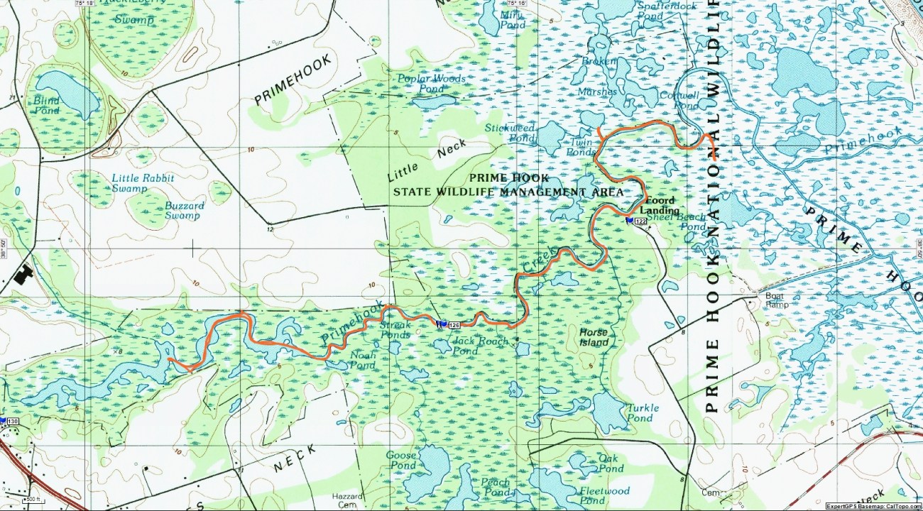
While there are several options for accessing Prime Hook Creek we chose Foord’s Boat Ramp just off the entrance road about 1/2 mile before the Refuge Visitor Center. Arriving there in early August 2017 one could see the dramatic scenery change from our photos of 2014. We paddled Prime Hook in 2015 and 2016, but the impact of the change was most obvious in the summer of 2017.


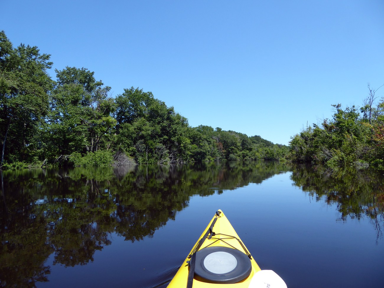
Approximately 1.6 miles from Foord’s Landing the scenery begins to dramatically change. By the 2 mile mark one reaches an area of banks lined by hardwood forests. While still swampy on one shore the other shore resembles a freshwater stream. Several large ponds open up, and one can spend a considerable amount of time investigating these turtle filled areas. There are very few places to put ashore. Poison Ivy and Sumac grow rampant along the bank. One can continue upstream to Brumbley Family Park on Waples Mill Pond. This alternate put in spot is located at the intersection of Rt. 5 and Rt. 1. A trail map from Prime Hook Wildlife Refuge provides detailed information. From Foord’s Landing Waples Mill Pond is approximately 5 miles upstream.
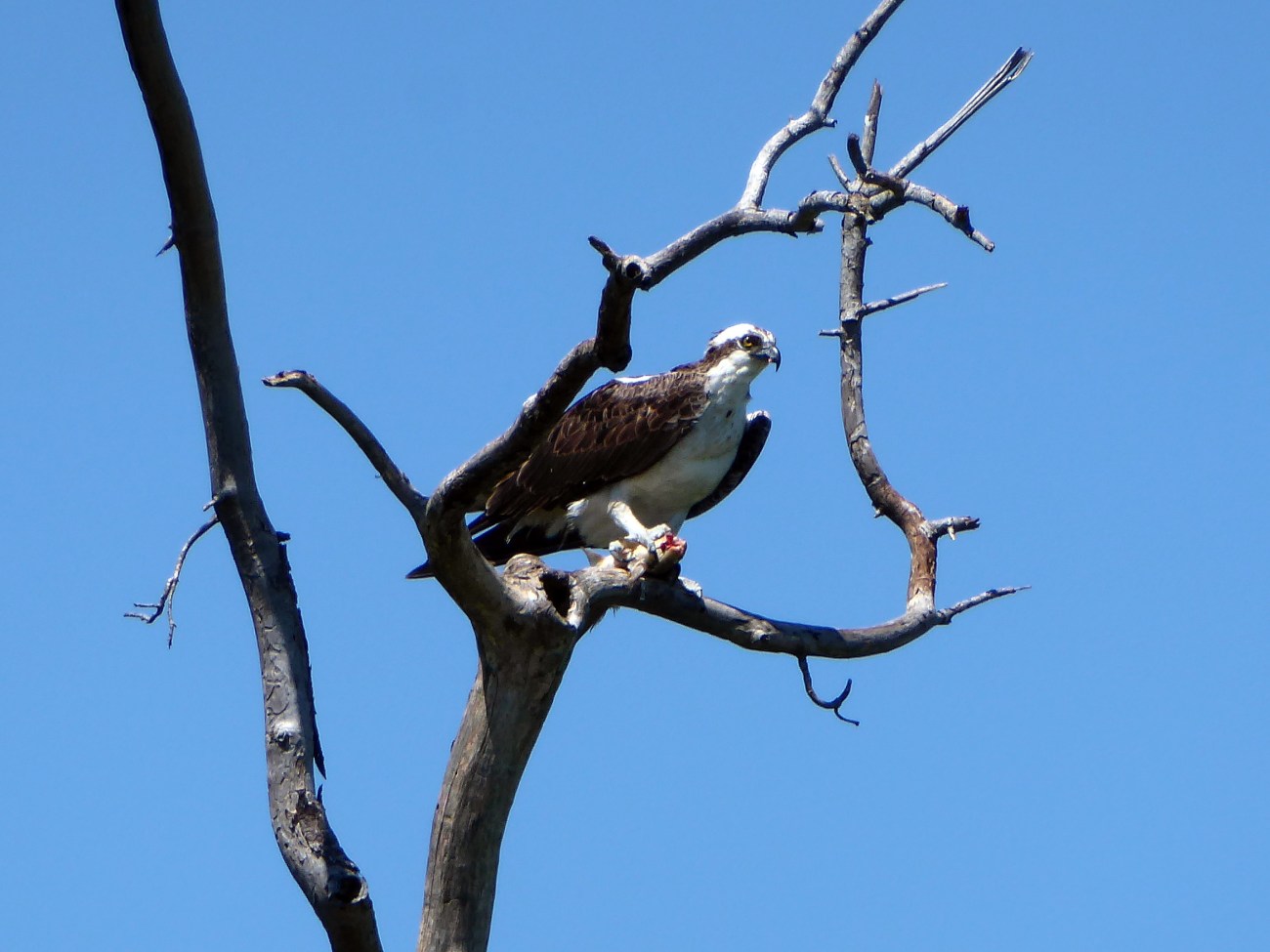
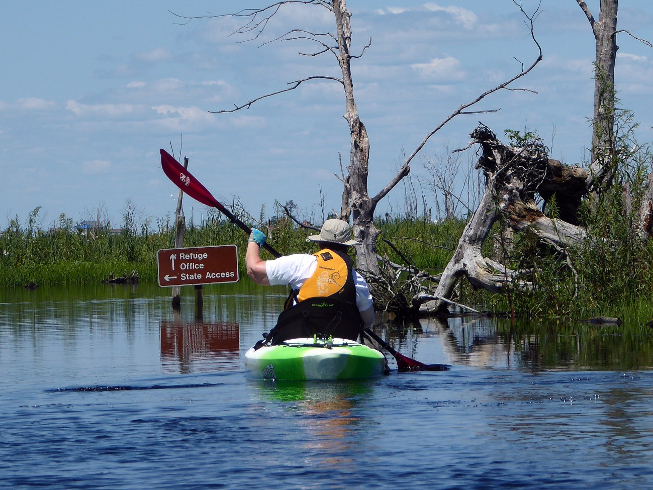
On this trip, after returning to Foord’s Landing, we chose to paddle the opposite direction towards more open water and the Refuge Office put in. In the past this area was closed due to storm damage. From September 15-March 1st it’s always closed for hunting. Within 1/2 mile one begins to enter more open water and shore birds become more abundant. On our next trip we intend to explore this area more thoroughly.
GPS Topo Map – Put-In Ramp at Waymark 122
Prime Hook National Wildlife Refuge https://www.fws.gov/refuge/prime_hook/
Put In: Foord Landing – no services, restrooms are located at Visitor Center
Food & Gas available in Milton, DE.
For more Kayaking Delmarva blog posts visit our Blog Index.

