A 2020 update to the NASA Docks location. This area is very remote and on our last trip there we chose to kayak elsewhere due to questionable activity in the area. We did not feel comfortable leaving our vehicle unattended. Make your own decision but we have chosen to remove it from our kayaking locations.
Sometimes in August perfect kayaking days occur. Temperature in the mid 80’s, slight breeze and beautiful blue skies. On such a day we drove south to Mappsville, VA and the Old NASA Ferry Dock Landing in Accomack County, VA.
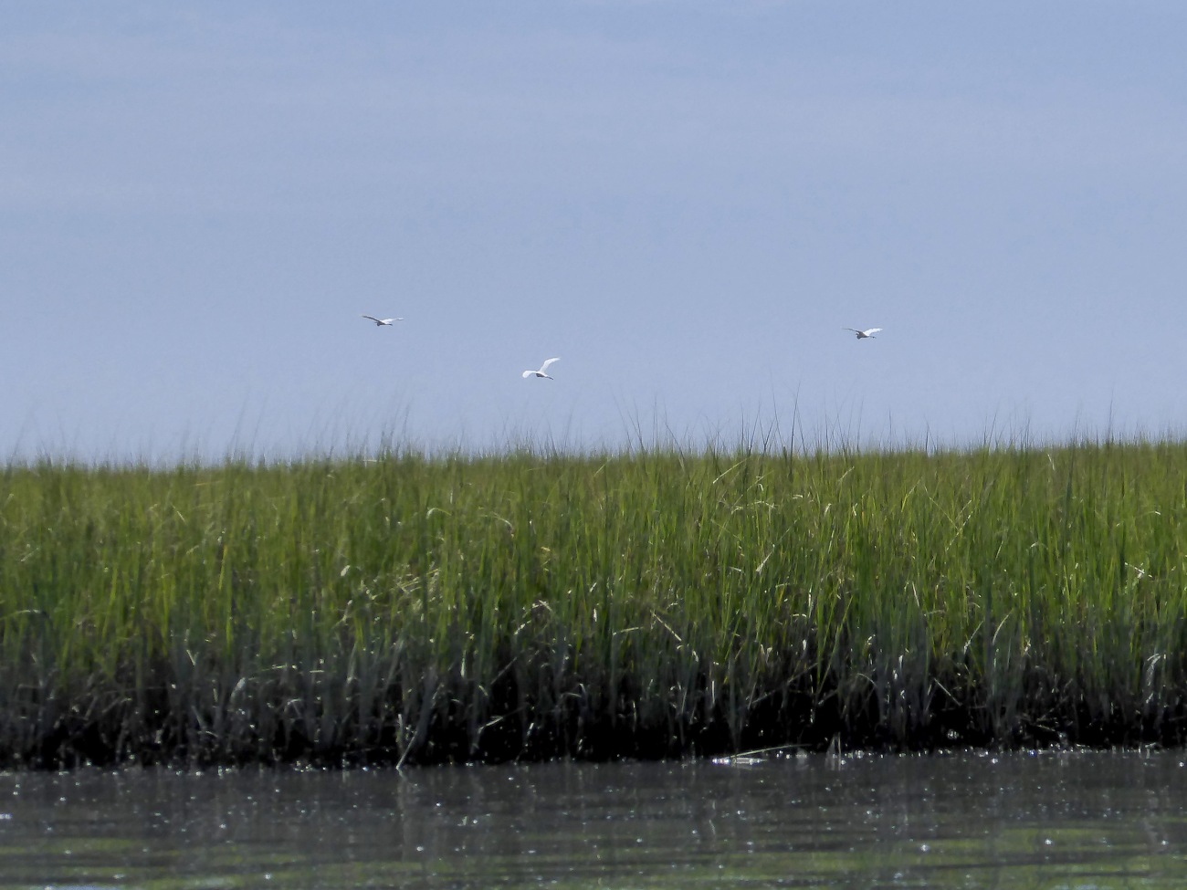
From the launch site paddlers can choose to go upstream on Assawoman Creek or into Woman’s Bay towards the Wallops Island NASA Launch Site. Previously, we paddled Assawoman Creek upstream for several miles through an area full of Snowy White Egrets. This trip we chose to investigate the area closer to Wallops Island.
Launching just before low tide a Tri-Color Heron flying along Assawoman Creek greeted us. Just the beginning of a bountiful day of bird sightings.

Detailed descriptions of the Virginia Seaside Water Trail , of which this paddle is a part, are located online. However, even if using the online descriptions a good GPS is necessary in the area. For this trip the online directions mentioned several numbered markers which we suspect a storm destroyed.
Leaving the launch site we paddled out Assawoman Creek and along the edge of Woman’s Bay heading directly towards the NASA water tower. Snowy Egrets flew beside us through the marsh.
We spotted much movement and splashing along the muddy banks as we approached. With a tele photo lenses we identified the large and small turtles on the bank and in the water.

Reaching the edge of Wallops Island we turned south into Hog Creek. The lowering tide began to expose tidal flats populated by the usual shore birds. The southern tip of Wallops Island is only a dune wide, and the surf could be heard crashing on the far side. However, we knew putting ashore would result in law enforcement company, so we chose to stay in our kayaks. Our GPS map seemed to show the tip of Hog Creek connected to other waterways. However, we’ve learned the marshes are continually changing and evolving. Hog Creek ended in a small cove just before the tip of Wallops Island.
![]()
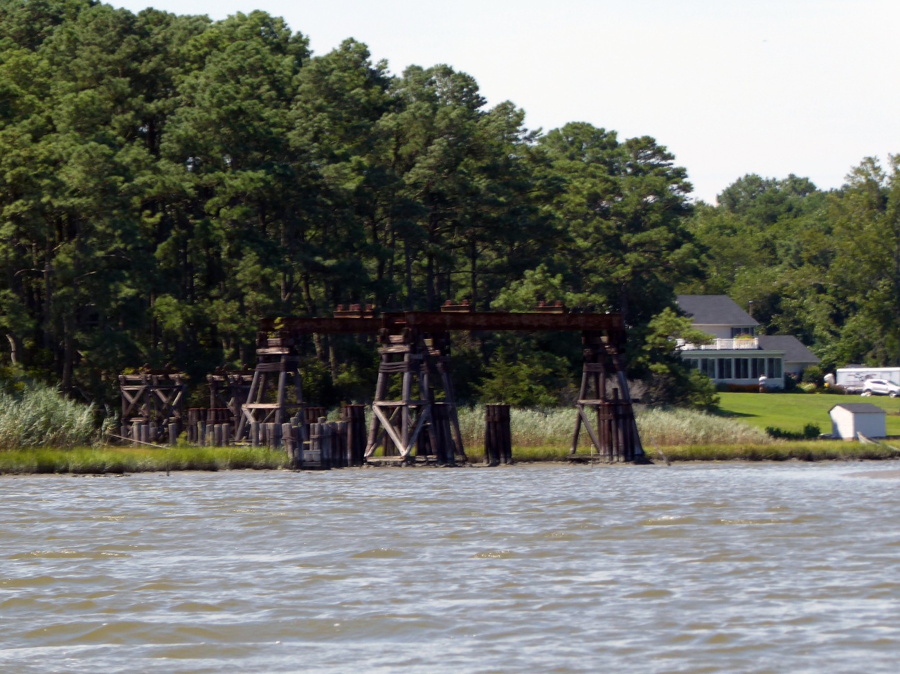
Retracing our route we viewed the Mid-Atlantic Regional Spaceport Logo on a launch gantry, and then entered Little Cat Creek. With the tide changing we now floated along viewing the variety of birds on the tidal flats.
The bird sightings on this trip were plentiful. A small tri-color heron watched us from the beach.

Only occasionally are we treated to the sight of American Oystercatchers. We saw not one, but a number of flocks on the tidal flats.

After floating and bird watching, we paddled back toward the Old Ferry Landing. I’ve done some research but found little information on this site. Our theory is ferries used the site to bring supplies to Wallops Island before a causeway was built. With the tide just turning and again flowing in a nice current existed for the return paddle.
Unfortunately we discovered at low tide the boat launch ramp presents a challenge. Next time we’ll time our return to allow a little higher water level. As it was the mud coated everything, but did not ruin a great day of bird watching. 
Topo map of our trip – put in at waypoint 141
 Directions: From MD. Rt. 13 south just over 11 miles. As you enter Mappsville watch for Davis Rd, RT. 794 on left. (signs are small). Turn left onto 794. At stop sign bear left onto Rt. 689, Mappsville Rd. Proceed 1.8 miles, turn left onto Rt. 730. Launch ramp at end of road.
Resources: Virginia Dept. of Environmental Quality has detailed descriptions online of paddling trips along the Virginia Seaside Trail.
Services: No facilities at launch ramp. Small general store in Mappsville. VA Welcome Center on Rt. 13 makes good rest stop.
For more Kayaking Delmarva blog posts visit our Blog Index.


Very informative post. Thanks!
LikeLike
Thanks! It was a beautiful place and we definitely recommend for fellow kayakers.
LikeLike