Soft shell crabs for lunch harvested right next to our restaurant. A main attraction on a kayaking trip near Saxis, VA.
We launched from the Hammock Landing launch on Messongo Creek near Saxis, VA. Saxis (and Guard Shore) WMA surround the area. Silky smooth waters on Messongo Creek beckoned us to spend the day.
Turning towards the Bay we paddled out Messongo Creek. Saved for another day, a trip upstream on Messongo Creek next to the WMA promises possible great birding.


With the marsh on our right we paddled toward Back Creek, a direct route to Saxis. We’d already confirmed a lunch stop at Capt. E. Hurricane Grill and Bar. Cormorants flew in abundance. Three sat on sticks watching as we paddled by. The bird sightings continued to be plentiful throughout the day.


As we approached Saxis a heron on an old dock officially welcomed us. A town boat ramp exists next to Capt. E’s allowing us to put ashore for a perfect lunch stop. In good weather “the beach” at Capt E’s is open for eating on the water. What a place to watch fisherman catching eels and birds flying. Of course lunch was all about seafood, and I highly recommend the soft shell crabs! We even toured the soft shell crab tanks next door and received a private lesson in identifying crabs ready to molt.


Leaving Saxis we watched a very mangy fox patrolling the island beach across from the launch site. Spotting a bald eagle in a pine tree we realized an extra eagle sat higher up behind a branch.


Paddling along the breakwater we saw dozens of piping plovers sitting on the breakwater. Rounding the end of the breakwater a beach covered in a variety of shorebirds came into view.


We began our counterclockwise paddle around Tunnel Island. Very soon we passed two large coves in the island. With beautiful beaches they promised to offer a fun paddle on another day. On this trip we continued along the shoreline and landed on the second large beach half way up Tunnel Island. Beautiful waves mesmerized us along the shore line. Inland throughout the marsh we spotted birds in areas of standing water.


Following our beach visit we continued around Tunnel Island headed to Hammocks Landing under bright sunny skies. Arriving to the landing the GPS confirmed this trip totaled over 11 miles. A great day on a cool fall Saturday.
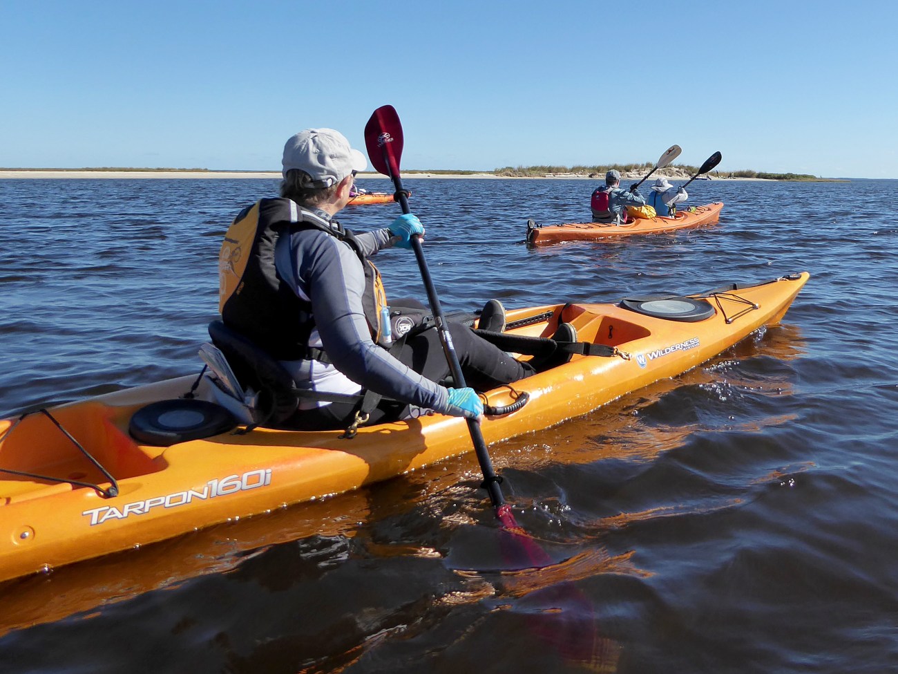
Paddling back to Hammock Landing
Topo map. We put in at Hammock Landing (waypoint 145) and then took a shortcut at Back Creek to arrive at the town of Saxis. After lunch at Captain E’s we went counter-clockwise around Tunnel Island to return.
For more Kayaking Delmarva blog posts visit our Blog Index.
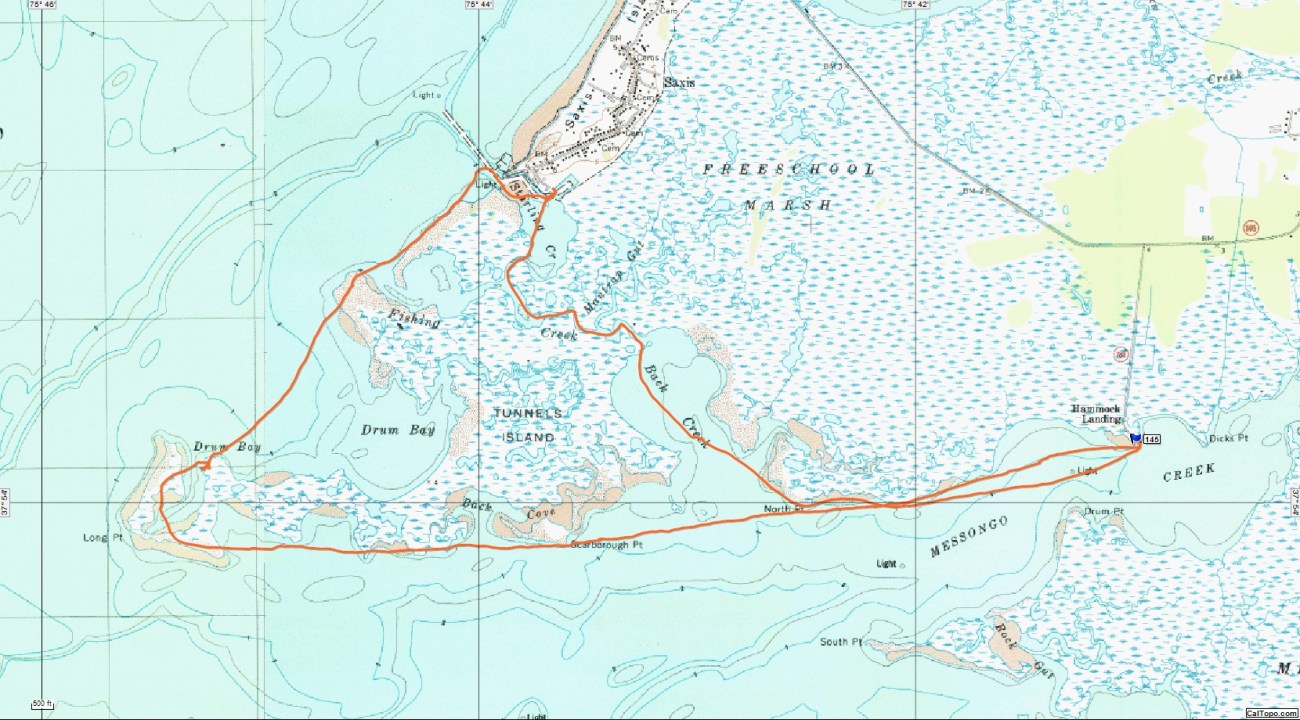
Topological Map of Saxis trip.
Directions to Hammock Landing :
South on Va. 113.
Right on Rt. 695. (app. 10 miles south of intersection of Rt. 13 and 113 in Pocomoke.)
Left on Hammock Landing Road (app. 7-8 miles)
Launch at end of road.
Services:
Port a John at Launch Site
Several small restaurants in Saxis.

