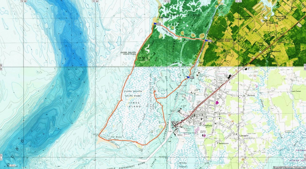
Paddlers at Janes Island State Park can choose to paddle inland marshes, tidal rivers and the Chesapeake Bay. On an 11 mile paddle we looped the lower part of Janes Island.
With 7 marked water trails at Janes Island SP endless options exist for combining trails. The state park posted colored trail markers for most of the trails. The Maryland Department of Natural Resources publishes an excellent trail guide available online and at the camp store at the marina.
On our paddle to explore the southern part of Janes Island, we launched from the floating dock at the park marina. Paddling south on Daugherty Creek, Crisfield is always in sight in the distance. On this part of the narrow creek a wooded shoreline borders one on the Janes Island side.


Bird sightings began early on this day. A great blue heron perched on one of the many fishing traps lining the creek, while a belted kingfisher flew back and forth finally landing for a decent photo. Photographing kingfishers always challenges our photographer, and for once he was successful. Nearly every kayaking trip on DELMARVA includes an eagle sighting. On this trip the eagle circled over Crisfield as we approached.


At one point we thought our GPS indicated a gut through the marsh to the Chesapeake side of the island. Investigation proved us wrong. Shifting marshes challenge even updated GPS maps. Many days we combine the use of our GPS with Goggle Maps on an iPhone to find our location.
Daughterly Creek becomes Little Annemessex River passing Crisfield. Working fishing boats flowed in and out unloading their catches near the City Dock.


As you spot the City Dock on your left the water trail begins to bear to the right around Long Point. Using our GPS we saw a gut going behind a small island. Some maps label this Daughterly Creek. A nice sandy beach beckoned us for a long lunch break.
Across from the beach we could see the remains of an old factory chimney, part of the L.E.P. Dennis Plant which manufactured fish oil and fertilizer. Fire destroyed the plant in 1932 leaving only the chimney. Concrete vaults, originally intended to stop erosion, line the shore.


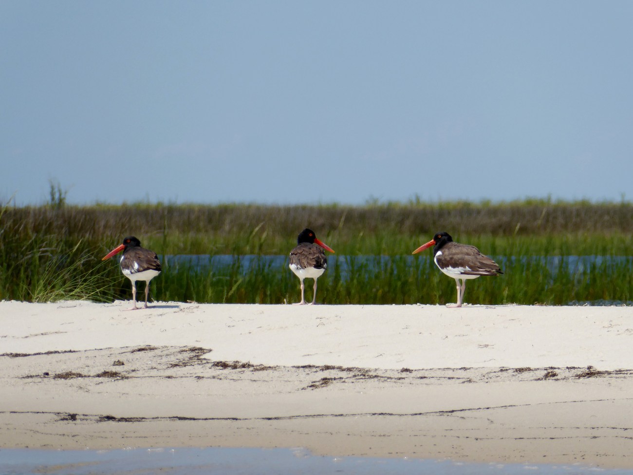
From our lunch stop we entered Old House Cove. Paddling to the end of the narrow strip we carried our kayaks across the sand to the beach where the fun began. As we headed North out into the Bay we saw our favorite shorebird, the American Oystercatcher. Three of them lined the beach, and their bright orange eyes are easily seen in our photo.
Smith Island in the distance divides this area, Tangier Sound, from the Chesapeake Bay. For the next three miles the rolling waves challenged our kayaks and paddling skills. Once again our Wilderness Systems 160i sit on tops proved up to the challenge. Several times we put ashore riding the surf into the beach. Re launching was not a pretty sight, as getting into the kayak and quickly paddling away from the beach presented a challenge. Our sit on tops made this challenge easier. Reaching Flatcap Beach a short portage across the sand and we entered Flatcap Basin. Taking a break on the sand we watched Semipalmated Plovers and Sanderlings walk along the beach. From this spot a quick mile paddle brings one back to the marina at Janes Island State Park.


Topological Map of our paddle around the bottom half of Janes Island.
Services: Restrooms at state park marina.
Boat Launch: Canoes/Kayaks may launch from floating dock for free. Otherwise, $7 fee to launch from boat ramp. A word to the wise. The floating dock is a challenge.
Crisfield: Restaurants, motels etc.
For more Kayaking Delmarva blog posts visit our Blog Index.

