Capt. John Smith’s presence on the Pocomoke River near Pitt’s Landing is well documented. On his trek up the Pocomoke to find drinkable water Smith passed Pitt’s Creek which today probably has changed little in appearance. Pitt’s Landing, on Bell Rd in New Church, VA., provides paddlers access to Pitt’s Creek. Signage at the launch ramp details Capt. Smith’s expedition into this area.
From the launch ramp a half mile paddle upstream on the Pocomoke brings one to Pitt’s Creek. If you’re lucky the same Bald Eagle will greet you on the tall dead tree at the creek mouth. Boat traffic on the Pocomoke moves quickly so kayakers should avoid the boat channel.

Bald Eagle guarding the entrance to Pitts Creek
We launched on a falling tide on a late August Sunday. Already we felt the coolness of an early autumn breeze. The Bald Eagle flew upstream as we approached, and we continued to see him throughout the day.
Pitts Creek winds in big lazy loops through the marsh between occasional hardwood banks for miles. With the tide low we hoped to see more birds on the tidal flats but spotted very few. However, the bald eagles made for excellent company, appearing many times.
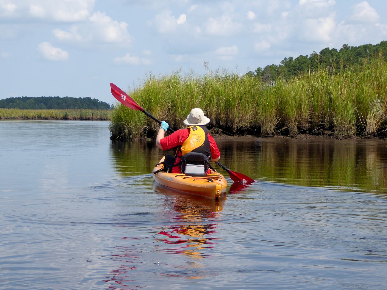
Entering Pitts Creek
On every muddy bank fiddler crabs ran for shelter as soon as we approached. Only one hung around long enough for a photo.
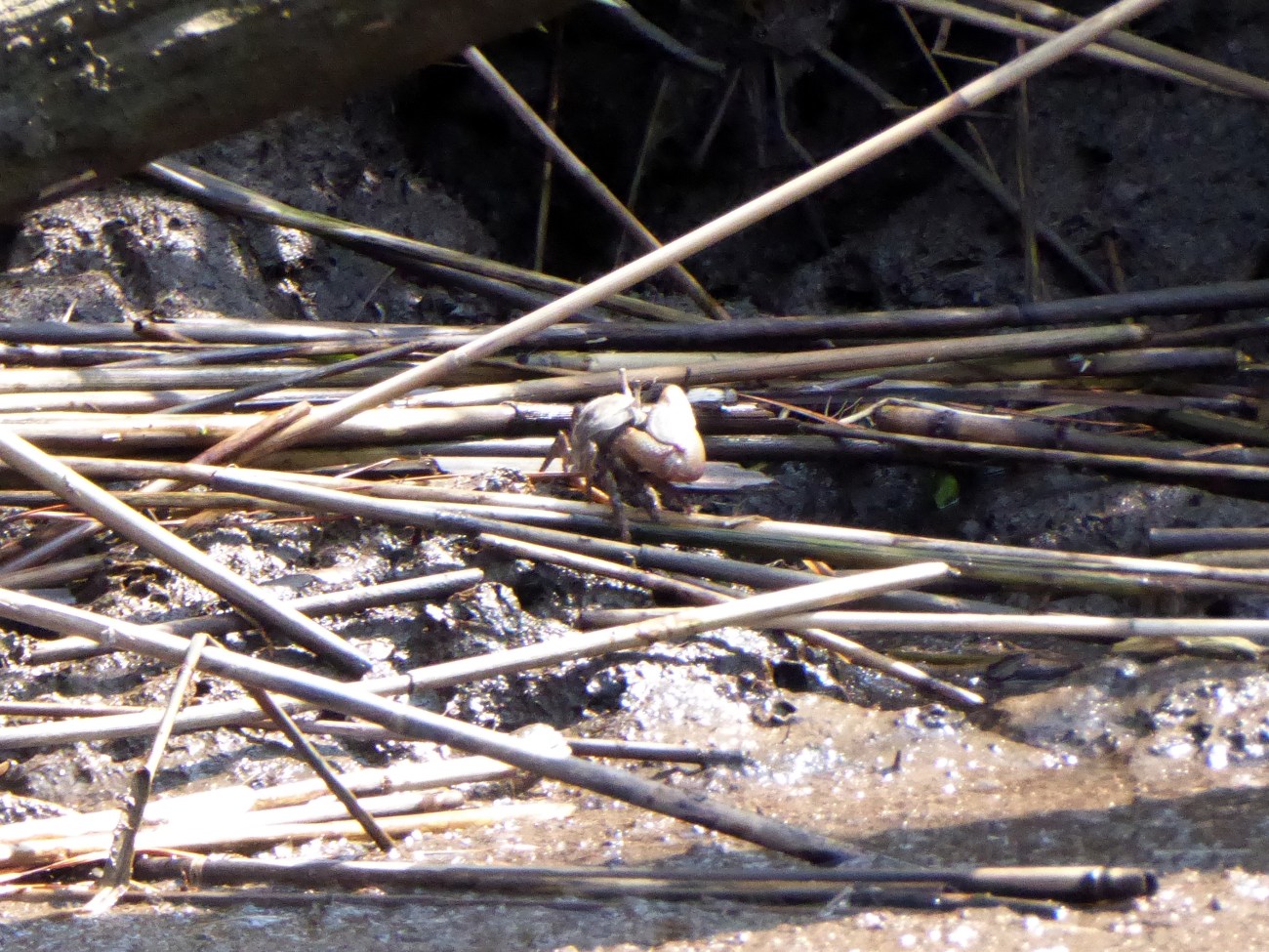
Fiddler Crab
Pine forests border portions of the creek. Sitting very still the sound of the wind blows gracefully through the pines. It’s in these tall pine trees we often spot eagle nests. Since the shore birds made themselves scarce on this day, we spent the time scanning the trees for eagle nests.


With binoculars and patience, we successfully spotted a nest. Due to it’s medium size this probably was a newer nest. Shortly after we finished a conversation about how close together eagle pairs might nest, we spotted the second nest. Much larger, this nest had obviously been in place longer. These may be two pairs of Bald Eagles, or possibly the same pair. Bald Eagles occasionally build two nests and alternate their use of them.


Numerous wildflowers still bloomed in the marsh and several large stands of the invasive Phragmites are present. We even stopped while a beautiful dragonfly chose to pose for his photo.


After passing the second and larger eagle’s nest we decided to turn around and retrace our way back to Pitt’s Landing. From viewing this area on Google Earth it seems one can paddle for a number of miles.
Approaching the Pitts Creek/Pocomoke intersection we could see a large tugboat heading for the same spot. Pushing a long barge we agreed giving him the right of way would be a smart idea. Our curiosity was peaked as to how the barge and tug would negotiate the sharp U bend in the river. We hugged the far shore while watching the tug very slowly make the turn. Returning to Pitts Landing at high tide allowed us to use the soft landing in place for kayaks.


Pitts Creek makes for a nice paddle, of your chosen length, into an area where you might imagine Capt. Smith himself walked. Quite a bit of information exists online about the Captain John Smith Chesapeake Historical Trail. . In later blog posts I’ll identify some of the other locations along this history trail ideal for paddlers and explorers.
Topological Map of our 7.6 mile journey

Directions: For Google Map directions search “Pitts Landing, New Church, VA”
Services: Port a John at Launch Site. Gas Stations/Convenience Stores at VA/MD line on Rt. 13. Full Services in Pocomoke, MD.
For more Kayaking Delmarva blog posts visit our Blog Index.
Share this:

Categories: All Things Kayaking, Bald Eagles, kayak, Pitts Creek, VA Eastern Shore
